Project / Architecture / Research /
Pivoting the Pearl
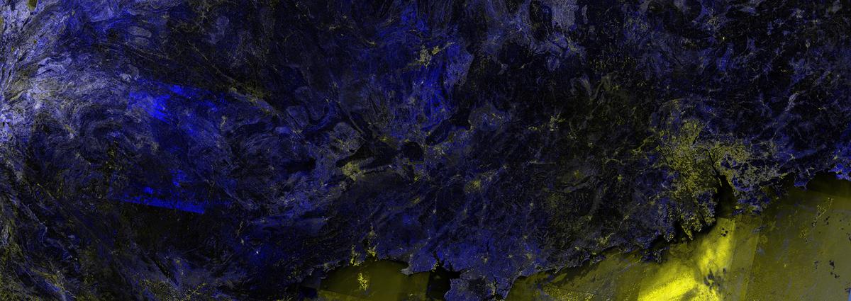
Plume of the Pearl River Delta
A proposal to reframe the Pearl River Delta as a platform for ecological investment, stakeholder negotiation, and adaptive simulation.
- Type
- Geospatial research and project note
- Region
- Pearl River Delta and Greater Bay Area
- Focus
- Operating context, digital twins, ecological judgment
- Data
- Landsat 1982-2020, Sentinel-1 2015-2020, stakeholder mapping
Project Context
Plume of the Pearl River Delta is a proposal to reframe one of the fastest transforming regions on Earth as a platform for ecological investment and stakeholder negotiation.
The delta is a landscape in motion. Urban expansion, land reclamation, and global logistics converge to make it a defining site of the 21st century. What appears as seamless growth is in fact a complex interplay of politics, legislation, engineering, and ecology. The result is a system under pressure, where the current trajectory is increasingly unsustainable.
The argument of the project is that the Pearl River Delta cannot be governed as a smooth logistics and urban-growth machine. Its future depends on making ecological volatility, political negotiation, and infrastructural dependency visible within the systems used to plan it.
Operating Conditions
The Pearl River Delta is often represented through growth: ports, airports, factories, finance, housing, corridors, and reclamation. The operating context is broader than that. Each expansion also redistributes risk through water, soil, labour, regulation, public health, and ecological exposure.
The project treats this as an interface problem as much as a planning problem. If a system only shows throughput, it trains decisions around throughput. If it can expose constraints, dependencies, and consequences, it creates better conditions for professional judgment. The operating boundary matters because it decides which pressures become visible, which remain external, and which forms of accountability can enter the model.
Digital Twin Boundaries
The transformation of the delta is increasingly mediated by the digital twin. These tools, powered by artificial intelligence, are designed to optimise, predict, and control. They create smooth, mechanical models of reality that promise efficiency, but often obscure the volatile, metabolic conditions of the delta itself.
Instead of treating the digital twin as only a technical instrument, Plume of the Pearl River Delta reframes it as a liminal space. The twin becomes a place where uncertainty can be held, tested, and negotiated rather than erased. What is counted as part of the system? What is treated as external? Who is authorised to act on the model? These questions determine the kind of intelligence the interface can support.
- Reframe the digital twin as a space for sensitivity and negotiation, not just replication.
- Surface ecological priorities alongside infrastructural ones.
- Use simulation to hold uncertainty rather than erase it.
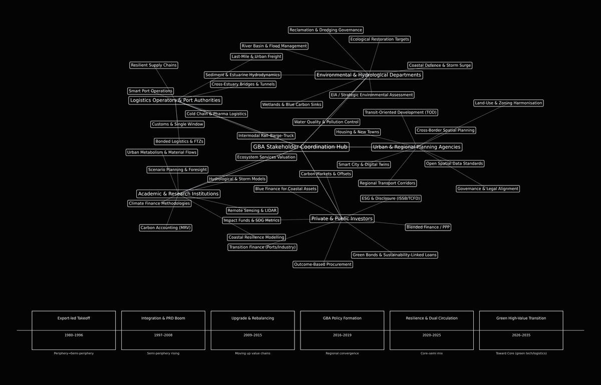
Stakeholder Negotiation
In this plume, ambiguity becomes an asset. It allows multiple stakeholders, including governments, manufacturers, developers, investors, researchers, and ecological communities, to experiment, negotiate, and co-exist within uncertainty rather than attempting to erase it.
The project proposes the digital twin as a negotiation surface rather than a purely technical instrument. A system can recommend, route, rank, and simulate, but its authority depends on what it has been delegated to do, by whom, and under what obligations. The role of the model is not to force premature consensus, but to make dependencies and conflicts visible enough for decisions to be contested with discipline.
Research Method
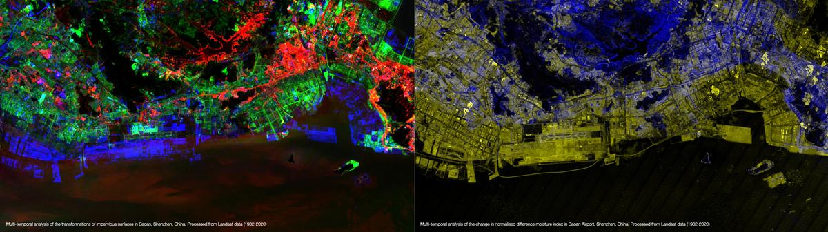
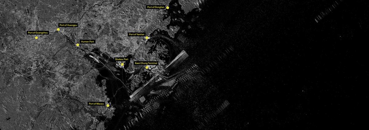
The research combines multi-temporal geospatial analysis with stakeholder and governance mapping. Landsat imagery is used to track long-term transformations in moisture, water, and impervious surfaces. Sentinel-1 logistics mapping brings transportation and port infrastructures into the same frame.
These layers are not used to produce a single clean answer. They support operational questions: where is the system under pressure, where are decisions being displaced, and which signals should alter the conversation before a plan becomes irreversible?
- Track urbanisation, reclamation, logistics, and hydrological change as related systems.
- Treat ecological indicators as planning inputs, not after-the-fact mitigation evidence.
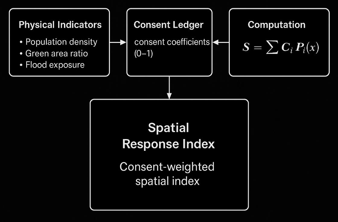
- Connect physical exposure with community feedback through consent-weighted spatial models.
- Pivot investment conversations from extractive urban growth toward ecological resilience.
Project Contribution
The delta is more than an industrial zone. It is a signal of planetary transformation, a place where the consequences of urbanisation, global trade, and climate change converge. By embracing its ambiguity, Plume of the Pearl River Delta opens space for new forms of ecological investment and adaptive governance models.
This project is about treating volatility as a resource. By recognising the plume as an arena for dialogue, it builds pathways for resilience, cooperation, and shared futures: models that move beyond the smooth surface of simulation and into the real complexity of the technosphere. The project connects ecological modelling to a broader question of operating intelligence: how systems hold context, how boundaries are drawn, and how judgment remains accountable when more decisions are mediated by automated tools.